In News
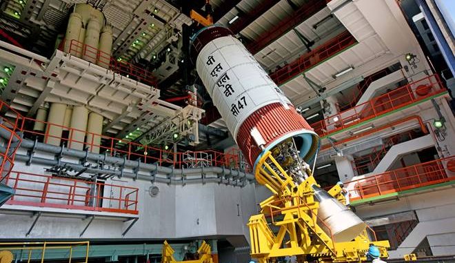
In the 49th flight of the Polar Satellite Launch Vehicle (PSLV), ISRO is set to launch the third generation earth observing satellite Cartosat-3 along with 13 other foreign satellites.
In-Detail
- The Cartosat-3 satellite is the third-generation of Earth-observing remote sensing satellites.
- It weighs 1,625 kg and is the main payload in the upcoming launch mission of PSLV-C47.
- The earth-observing satellites provide high-resolution images of the Earth to be used in 3-D mapping, disaster management, agriculture, water resources monitoring, urban and rural planning, border surveillance etc.
Earth Observation
- The next-generation satellite will be a part of India’s large constellation of Earth-observation satellites which includes RISAT, Reourcesat, Oceansat series and many more.
- All these satellites are providing theme-based remorse sensing data that is in demand.
- For example, RISAT and Resourcesat provide images through their high-resolution cameras of land and water resources.
- The Oceansat series satellites provide images of the oceans.
- INSAT 3D, INSAR-VRR or Megha Tropiques study the atmosphere.
- The data from these satellites are in demand both by the government agencies for planning and infrastructure development, as well as by the private companies to execute infrastructure projects.
Cartosat-3
- The full specifications of Cartosat-3 have not yet been revealed by the ISRO.
- The new satellite is an improvement over Cartosat-1 and 2 satellites.
- Launched in May 2005, Cartosat-1 is the first Indian remote sensing satellite capable of taking 3D images.
- It has a resolution of 2.5 metres.
- With Cartosat-1, Digital images of 15 towns were created at a scale of 1:10000. Earlier it was 1:50000.
- It was further used for creating an inundation vulnerability assessment of Indian coastal areas, estimating the status of irrigation potential etc.
- Cartosat-2 was launched in 2007 and it has a better resolution of 1 metre.
- Though ISRO has not revealed the specification of Cartosat-3, it is slated to have a better resolution at 0.25 metres.
- High-resolution data is in great demand.
- They are used in applications such as studying the spread of urbanisation, forest and vegetation cover etc.
- The demand is from the government, private companies and academics.
- ISRO is launching Cartosat-3 to cater to this demand.
PSLV-C47
- Apart from Cartosat-3, PSLV-C47 is also carrying 13 commercial nano-satellites from the US.
- Flock-4P satellites, also Earth-observation satellites, account for 12 of them.
- These are from a private company Planet.

Leave a Reply
You must be logged in to post a comment.